Devpost
Participate in our public hackathons
Devpost for Teams
Access your company's private hackathons
Grow your developer ecosystem and promote your platform
Drive innovation, collaboration, and retention within your organization
By use case
Blog
Insights into hackathon planning and participation
Customer stories
Inspiration from peers and other industry leaders
Planning guides
Best practices for planning online and in-person hackathons
Webinars & events
Upcoming events and on-demand recordings
Help desk
Common questions and support documentation
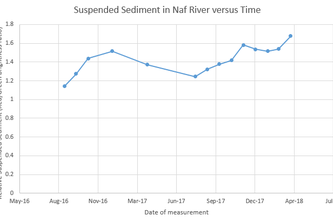
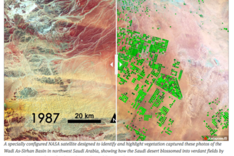
We use Planet's high-resolution satellite data to map deforestation and water quality in Rohingya refugee camps.
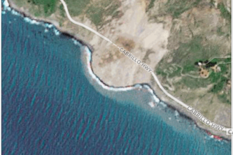
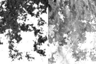
We assess the California landslide susceptibility and develop landslide auto-detection using machine learning
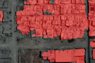
Fast assessment of infrastructure and housing damage following natural disasters
Flood Monitoring and Transit
We love all data including the noise!
Can we estimate California wildfire size by GGE and Planet datasets?
Cloud removal using Generative Adversarial Networks and hyperspectral images
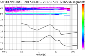
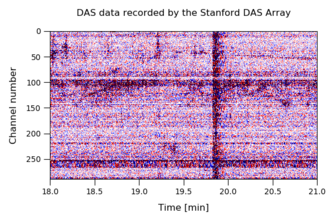
Analyzing measurements from fiber optic cables to detect seismic activity and other vibrations
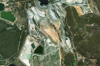
Leveraging planetary data for sustainable lithium sourcing options.
Groundwater is a non-renewable resource depleting from beneath the surface. We need simple ways to monitor it's use!
Machine Learning, Neural Network, Temperature Prediction
visualizearth is an interactive data visualization that displays trends in mean temperatures around the world.
3 Stanford undergrad, mission to detect forest fire, prevent lost of lives, act early
1 – 13 of 13